|
|
| Site Summary | ||||||||||||
|
||||||||||||
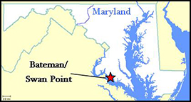
Site History The Bateman/Swan Point site is located within a 2,000-acre land tract that was granted to Captain James Neale by Lord Baltimore in 1642. This tract, known as Wollaston Manor, passed down in the Neale family for several generations. The Neale family was presumably responsible for the construction and initial occupation of the dwelling at 18CH354, which served as the manor house. At the beginning of the 18th century, Wollaston Manor was a relatively large plantation for the region, and the family was somewhat well-to-do. The site therefore started as an upper-middle class occupation. The dwelling at 18CH354 could not have been the original 17th-century Wollaston Manor, but it could have been built by the time Captain James Neale’s grandson, James Neale III, inherited the property in 1716. James Neale III died in 1725, leaving the Manor to his son James Neale IV. The direct line seems to have died with James IV because Raphael Neale, son of James Neale Jr’s brother Anthony, owned Wollaston Manor by 1745. Raphael Neale had his own estate, so he partitioned the property among his children. The portion of the property containing 18CH354 went to Raphael’s daughter Monica Digges and her husband Edward in 1755. The couple apparently lived in a newer house nearby which has also been excavated (18CH350). However, diagnostic artifacts indicate that 18CH354 was not abandoned until the period between 1760 and 1780, so the site was probably occupied by tenants, shifting the dwelling from an owner-occupied manor house to a rental property for unknown occupants.
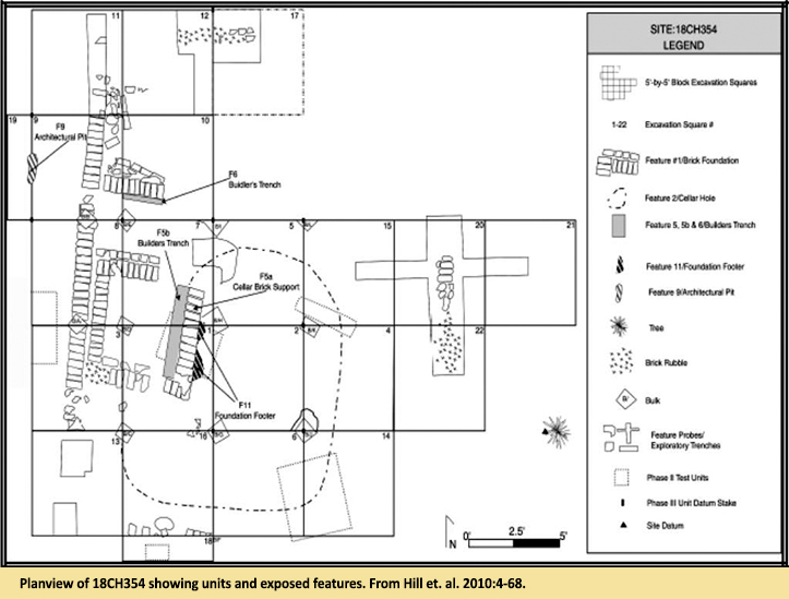
Archaeology The Bateman site was identified during a Phase I study of Swan Point in 1991 (Hopkins, Dinnel, and Collier 1991). In 2008 and 2009 Phase II and Phase III excavations took place since the site was slated for impact by construction of a beach house, club, and roadways associated with the Villages at Swan Point development. Data recovery at 18CH354 specifically targeted an 18th century dwelling foundation and its associated features. Twelve complete and nine partial test units were excavated to expose the remnants of brick foundations, builder’s trenches, and a dirt cellar. Excavation of the cellar indicated that domestic trash started to accumulate there in the second quarter of the 18th century and the fill gradually built up over the next 40-60 years. The presence of Astbury-type ceramics in the lowest level date the initial fill, but there is some question about whether the cellar enjoyed a period of “clean” occupation before trash accumulated. Two oyster shell middens (layers 5-6 and 12a-12b in Square 2), may signify deliberate capping of smelly trash, or possibly fill associated with the abandonment of the cellar. A notable difference in the cellar fill is represented by the faunal assemblage. Below the oyster middens domestic species such as cow and pig are represented, but above the oyster layers, the faunal assemblage is comprised almost exclusively of wild game such as fish and deer. The presence of a 1744 George II half Penny in the lower oyster midden indicates that the change in diet occurred after the direct line of Captain James Neale died out and the property was broken up amongst the children of Raphael Neale. The uppermost shell midden correlates with evidence of fire that may represent the razing of the structure. Subsequent layers would then represent post-occupation fill episodes with dirt and debris from around the site rather than deposition associated with incidental losses and deliberate discards in the cellar. Creamware appeared only in layers at or above the second oyster shell midden, and no pearlware was recovered. This suggests that the last fill episodes of the cellar took place at some point between 1760 and 1780. The two uppermost layers of the cellar fill contained a relatively high proportion of rubble and architectural debris, indicating that demolition debris was pushed into the cellar depression when the land went into to agricultural production. Summary by Sara Rivers Cofield References:
Archaeological collections from the Bateman/Swan Point site are owned by the Maryland Historical Trust, and curated at the Maryland Archaeological Conservation Laboratory. |
||||||||||||

|

|


